Tropical Storm LORENZO
Updated October 15, 2025 at 12:00 UTC
Located at 21.1°N, 44.5°W
Minimum Pressure: 1004 mb
Maximum Winds: 35 kt
Radius of Maximum Wind: 25 nm
Environmental Pressure: 1009 mb
Storm Radius: 100 nm
Current Conditions


Forecasts

Storm History


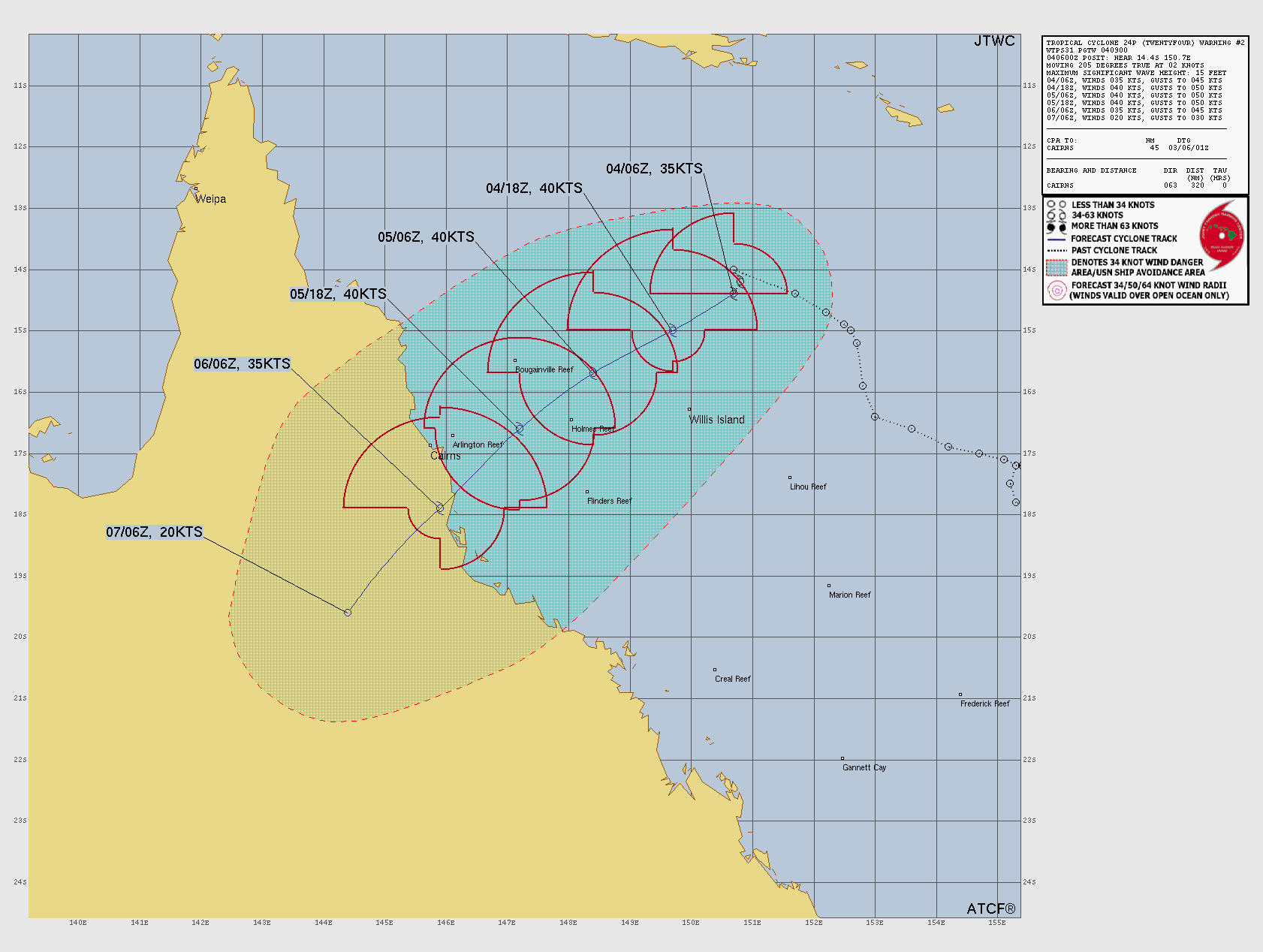
Tropical Storm TWENTYFOUR
Updated March 04, 2026 at 18:00 UTC
Located at 15.1°S, 149.9°E
Minimum Pressure: 997 mb
Maximum Winds: 35 kt
Radius of Maximum Wind: 35 nm
Environmental Pressure: 1002 mb
Storm Radius: 200 nm
Formerly Invest 91P
Current Conditions


Forecasts


Storm History


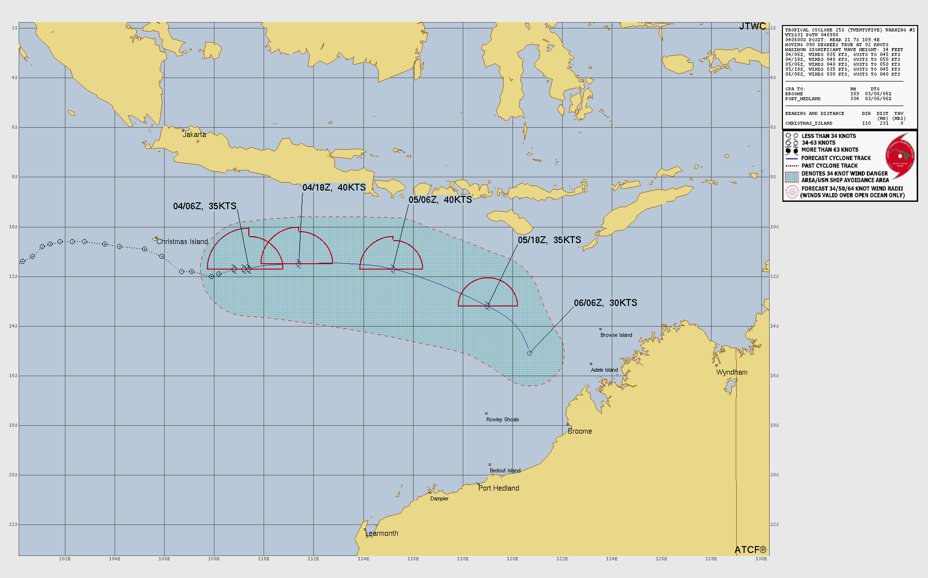
Tropical Storm TWENTYFIVE
Updated March 04, 2026 at 18:00 UTC
Located at 11°S, 111.4°E
Minimum Pressure: 998 mb
Maximum Winds: 35 kt
Radius of Maximum Wind: 20 nm
Environmental Pressure: 1004 mb
Storm Radius: 90 nm
Formerly Invest 90S
Current Conditions


Forecasts
Storm History


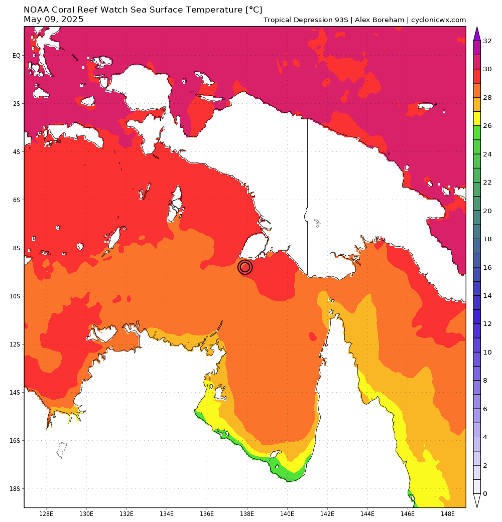
Tropical Depression 93S
Updated March 04, 2026 at 18:00 UTC
Located at 16.2°S, 120.2°E
Minimum Pressure: 996 mb
Maximum Winds: 30 kt
Current Conditions

Storm History


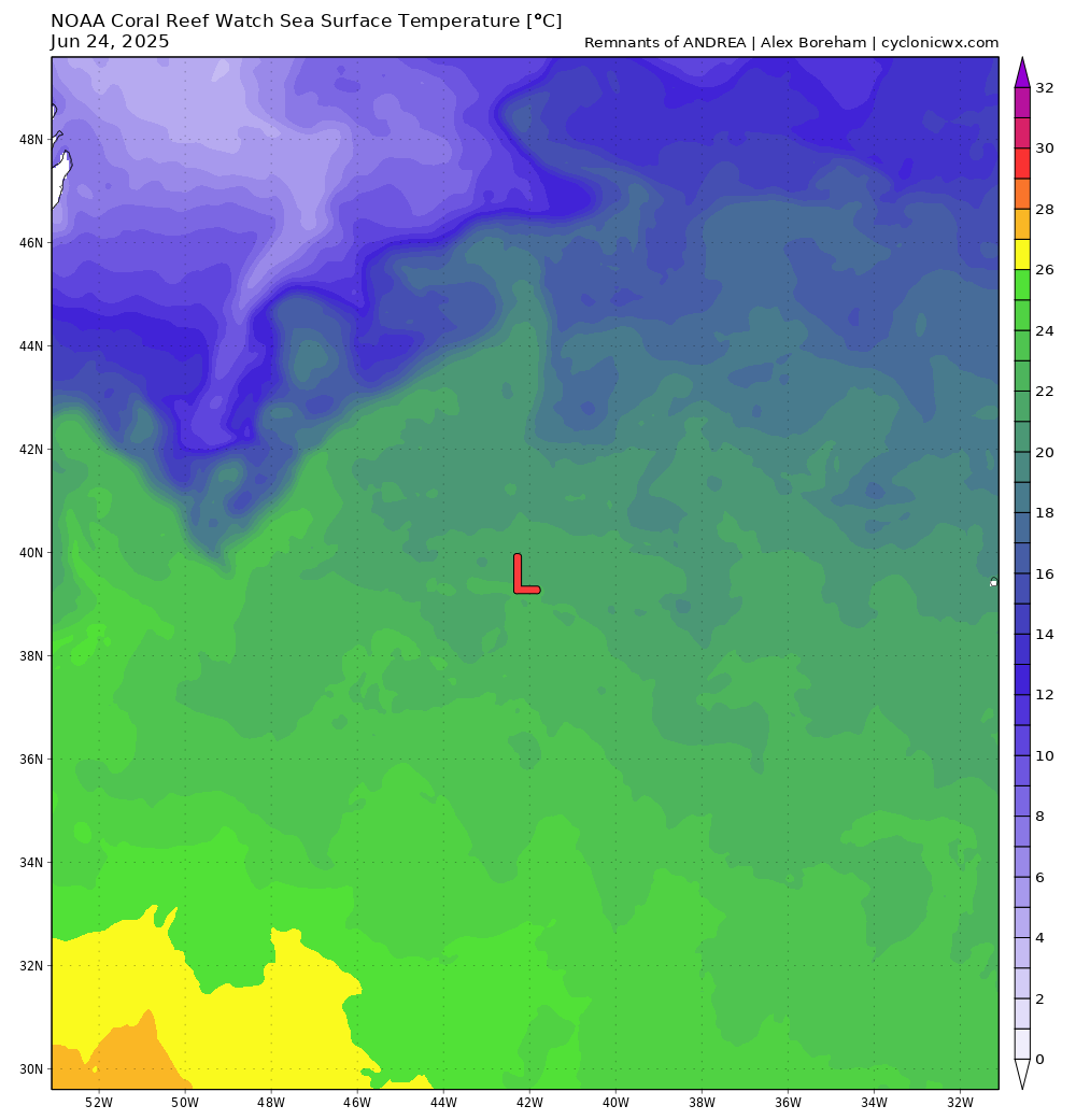
Remnants of ANDREA
Updated June 25, 2025 at 12:00 UTC
Located at 39.3°N, 42.2°W
Minimum Pressure: 1015 mb
Maximum Winds: 30 kt
Radius of Maximum Wind: 40 nm
Environmental Pressure: 1018 mb
Storm Radius: 60 nm
Current Conditions

Forecasts

Storm History


Invest 92P
Updated March 04, 2026 at 18:00 UTC
Located at 15.2°S, 136.3°E
Minimum Pressure: 1002 mb
Maximum Winds: 20 kt
Current Conditions


Storm History


Invest 95W
Updated March 04, 2026 at 18:00 UTC
Located at 6.1°N, 151.5°E
Minimum Pressure: 1008 mb
Maximum Winds: 15 kt
Current Conditions


Storm History


Remnants of FERNAND
Updated August 28, 2025 at 18:00 UTC
Located at 43°N, 39.1°W
Minimum Pressure: 1008 mb
Maximum Winds: 35 kt
Radius of Maximum Wind: 60 nm
Environmental Pressure: 1014 mb
Storm Radius: 80 nm
Current Conditions


Forecasts

Storm History


Remnants of ERIN
Updated August 27, 2025 at 18:00 UTC
Located at 58°N, 19°W
Minimum Pressure: 985 mb
Maximum Winds: 40 kt
Radius of Maximum Wind: 210 nm
Environmental Pressure: 1000 mb
Storm Radius: 500 nm
Current Conditions


Forecasts

Storm History


Remnants of DEXTER
Updated August 13, 2025 at 06:00 UTC
Located at 49.4°N, 12.2°W
Minimum Pressure: 1008 mb
Maximum Winds: 25 kt
Radius of Maximum Wind: 105 nm
Environmental Pressure: 1013 mb
Storm Radius: 220 nm
Current Conditions


Forecasts

Storm History


Remnants of KAREN
Updated October 11, 2025 at 12:00 UTC
Located at 51.3°N, 28°W
Minimum Pressure: 1005 mb
Maximum Winds: 30 kt
Radius of Maximum Wind: 20 nm
Environmental Pressure: 1011 mb
Storm Radius: 120 nm
Current Conditions


Forecasts

Storm History


Tropical Storm JERRY
Updated October 11, 2025 at 12:00 UTC
Located at 25.2°N, 63.3°W
Minimum Pressure: 1006 mb
Maximum Winds: 45 kt
Radius of Maximum Wind: 80 nm
Environmental Pressure: 1010 mb
Storm Radius: 120 nm
Current Conditions


Forecasts

Storm History


Remnants of IMELDA
Updated October 06, 2025 at 00:00 UTC
Located at 50.3°N, 33°W
Minimum Pressure: 988 mb
Maximum Winds: 45 kt
Radius of Maximum Wind: 80 nm
Environmental Pressure: 998 mb
Storm Radius: 140 nm
Current Conditions


Forecasts

Storm History


Remnants of HUMBERTO
Updated October 01, 2025 at 12:00 UTC
Located at 36.1°N, 65.5°W
Minimum Pressure: 981 mb
Maximum Winds: 65 kt
Radius of Maximum Wind: 30 nm
Environmental Pressure: 1003 mb
Storm Radius: 150 nm
Current Conditions


Forecasts

Storm History


Remnants of GABRIELLE
Updated September 28, 2025 at 18:00 UTC
Located at 38.5°N, 6.5°W
Minimum Pressure: 1012 mb
Maximum Winds: 25 kt
Radius of Maximum Wind: 180 nm
Environmental Pressure: 1012 mb
Storm Radius: 180 nm
Current Conditions


Forecasts

Storm History


This page uses data from the National Hurricane Center (NHC) and Joint Typhoon Warning Center (JTWC), with best track files through the Automated Tropical Cyclone Forecast (ATCF) system. Microwave imagery courtesy of the U.S. Naval Research Laboratory.