Current Storms:
Tropical Storm WUTIP
Updated June 12, 2025 at 18:00 UTC
Located at 17.7°N, 109°E
Minimum Pressure: 989 mb
Maximum Winds: 50 kt
Radius of Maximum Wind: 45 nm
Environmental Pressure: 1003 mb
Storm Radius: 260 nm
Current Conditions
Latest Satellite Image

Latest Radar Image
Wind Radii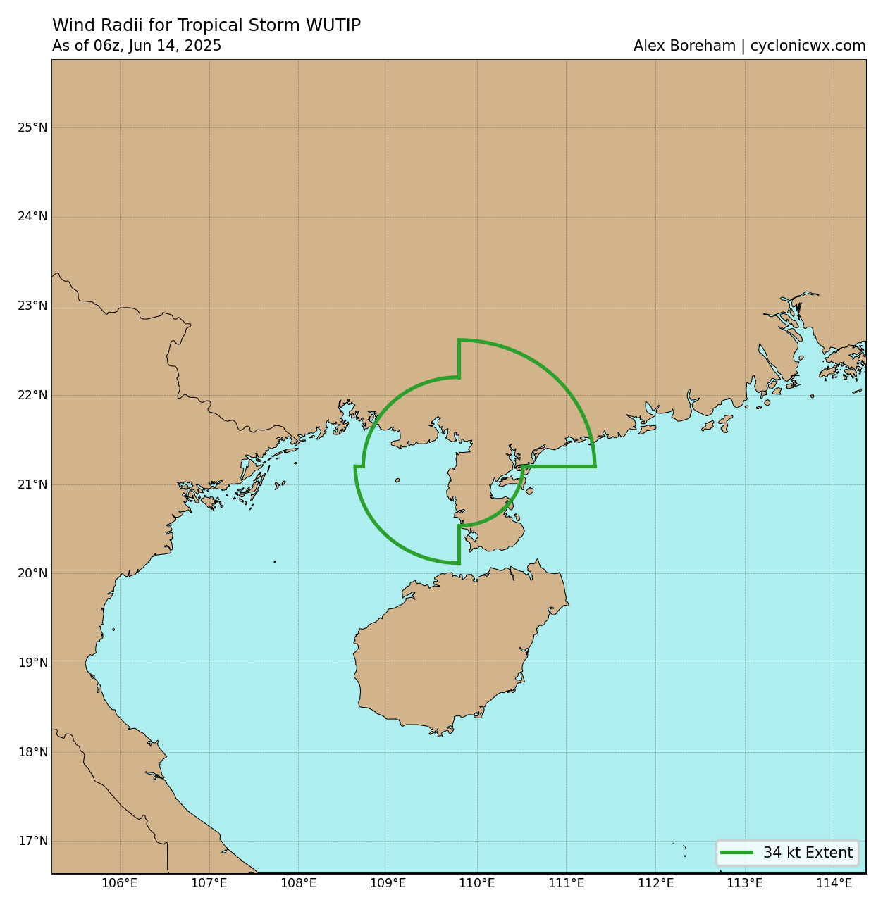
Sea Temperatures

34 GHz Microwave Imagery

89 GHz Microwave Imagery

Forecasts
Official Forecast

Storm History

Pressure and Wind History

Potential Tropical Cyclone FOUR
Updated June 12, 2025 at 18:00 UTC
Located at 11.1°N, 100.1°W
Minimum Pressure: 1006 mb
Maximum Winds: 30 kt
Radius of Maximum Wind: 150 nm
Environmental Pressure: 1012 mb
Storm Radius: 180 nm
Current Conditions
Latest Satellite Image

Sea Temperatures

Forecasts
Official Forecast

Latest SHIPS Forecast (click for bigger)

Storm History

Pressure and Wind History

This page uses data from the National Hurricane Center (NHC) and Joint Typhoon Warning Center (JTWC), with best track files through the Automated Tropical Cyclone Forecast (ATCF) system. Microwave imagery courtesy of the U.S. Naval Research Laboratory.