Tropical Storm NARDA
Updated September 22, 2025 at 00:00 UTC
Located at 15.1°N, 100.1°W
Minimum Pressure: 1006 mb
Maximum Winds: 35 kt
Radius of Maximum Wind: 60 nm
Environmental Pressure: 1009 mb
Storm Radius: 150 nm
Formerly Invest 97E
Current Conditions


Forecasts


Storm History


Hurricane GABRIELLE
Updated September 22, 2025 at 00:00 UTC
Located at 28.9°N, 62°W
Minimum Pressure: 992 mb
Maximum Winds: 65 kt
Radius of Maximum Wind: 20 nm
Environmental Pressure: 1013 mb
Storm Radius: 120 nm
Formerly Invest 92L
Current Conditions


Forecasts


Storm History


Super Typhoon RAGASA
Updated September 22, 2025 at 00:00 UTC
Located at 19.3°N, 122.9°E
Minimum Pressure: 910 mb
Maximum Winds: 145 kt
Radius of Maximum Wind: 25 nm
Environmental Pressure: 1004 mb
Storm Radius: 280 nm
Current Conditions


Forecasts

Storm History


Typhoon NEOGURI
Updated September 22, 2025 at 00:00 UTC
Located at 29.7°N, 151°E
Minimum Pressure: 950 mb
Maximum Winds: 105 kt
Radius of Maximum Wind: 5 nm
Environmental Pressure: 1010 mb
Storm Radius: 220 nm
Current Conditions


Forecasts
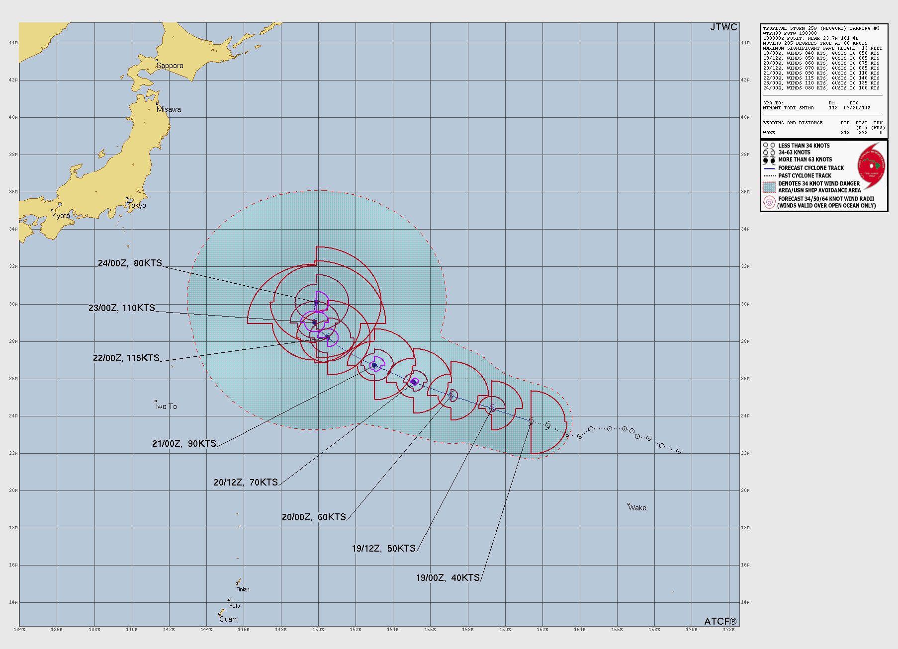
Storm History


Invest 92W
Updated September 22, 2025 at 00:00 UTC
Located at 10.4°N, 139.2°E
Minimum Pressure: 1008 mb
Maximum Winds: 20 kt
Current Conditions


Storm History


Invest 98B
Updated September 22, 2025 at 00:00 UTC
Located at 20.0°N, 89.5°E
Minimum Pressure: 1004 mb
Maximum Winds: 15 kt
Current Conditions


Storm History


This page uses data from the National Hurricane Center (NHC) and Joint Typhoon Warning Center (JTWC), with best track files through the Automated Tropical Cyclone Forecast (ATCF) system. Microwave imagery courtesy of the U.S. Naval Research Laboratory.