Hurricane ODALYS
Updated September 23, 2026 at 18:00 UTC
Located at 15.5°N, 127.5°W
Minimum Pressure: 984 mb
Maximum Winds: 70 kt
Radius of Maximum Wind: 20 nm
Environmental Pressure: 1010 mb
Storm Radius: 230 nm
Current Conditions


Forecasts


Storm History


Hurricane POLO
Updated September 23, 2026 at 18:00 UTC
Located at 15.5°N, 102.1°W
Minimum Pressure: 931 mb
Maximum Winds: 125 kt
Radius of Maximum Wind: 10 nm
Environmental Pressure: 1008 mb
Storm Radius: 180 nm
Current Conditions


Forecasts


Storm History


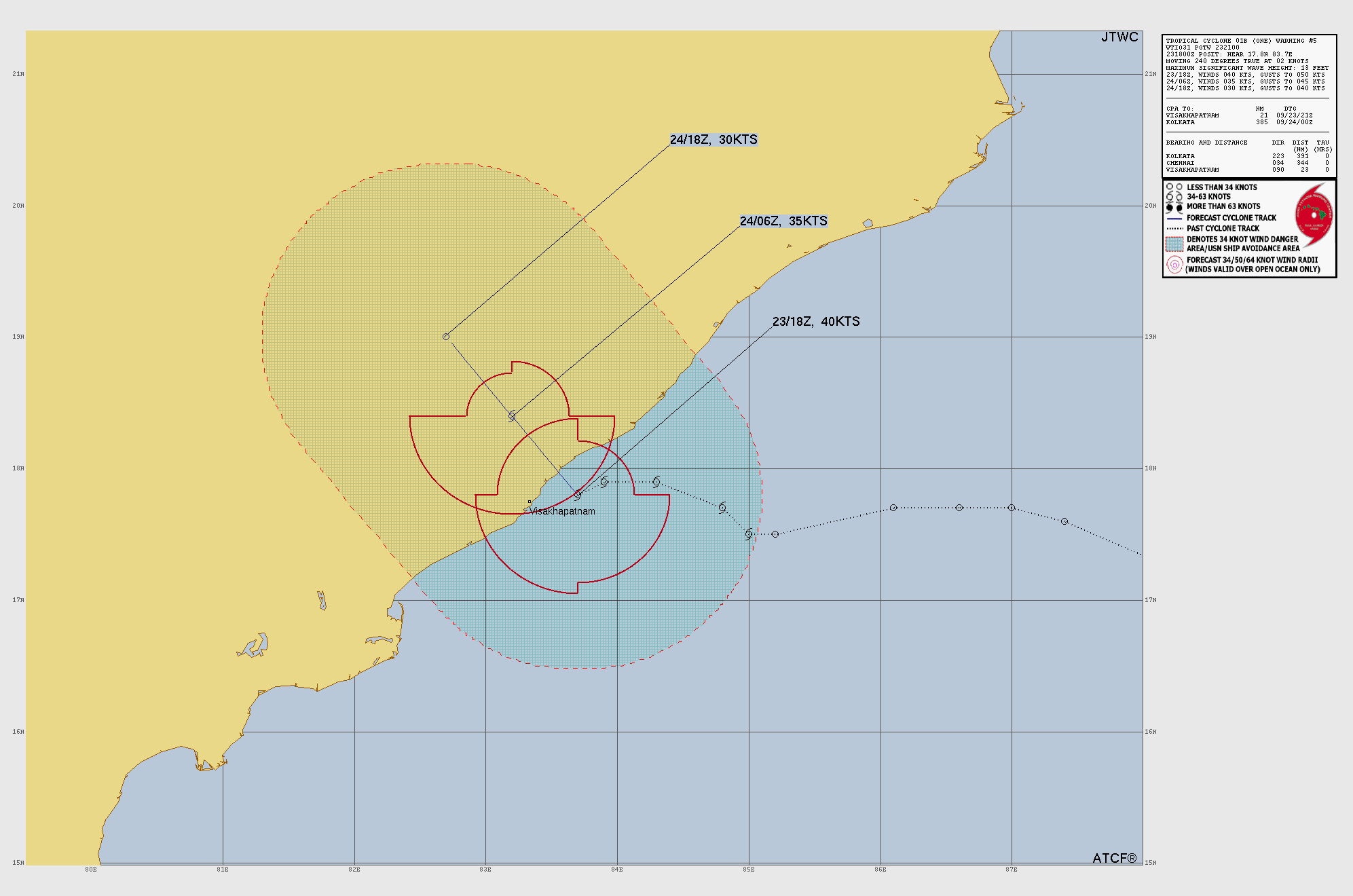
Tropical Storm ONE
Updated September 23, 2026 at 18:00 UTC
Located at 17.8°N, 83.7°E
Minimum Pressure: 995 mb
Maximum Winds: 40 kt
Radius of Maximum Wind: 20 nm
Environmental Pressure: 1004 mb
Storm Radius: 230 nm
Formerly Invest 95B
Current Conditions


Forecasts
Storm History


Tropical Storm SURIGAE
Updated September 23, 2026 at 18:00 UTC
Located at 17.2°N, 136.2°E
Minimum Pressure: 1005 mb
Maximum Winds: 35 kt
Radius of Maximum Wind: 35 nm
Environmental Pressure: 1010 mb
Storm Radius: 170 nm
Formerly Invest 91W
Current Conditions


Forecasts

Storm History


Tropical Depression FAY
Updated September 23, 2026 at 18:00 UTC
Located at 30.1°N, 38.8°W
Minimum Pressure: 1011 mb
Maximum Winds: 30 kt
Radius of Maximum Wind: 40 nm
Environmental Pressure: 1016 mb
Storm Radius: 140 nm
Current Conditions


Forecasts


Storm History


Tropical Depression FIFTEEN
Updated September 23, 2026 at 18:00 UTC
Located at 14.5°N, 155.1°W
Minimum Pressure: 1004 mb
Maximum Winds: 30 kt
Radius of Maximum Wind: 90 nm
Environmental Pressure: 1010 mb
Storm Radius: 230 nm
Current Conditions


Forecasts


Storm History


Invest 90L
Updated September 23, 2026 at 18:00 UTC
Located at 10°N, 17.2°W
Minimum Pressure: 1008 mb
Maximum Winds: 25 kt
Current Conditions


Forecasts


Storm History


Invest 92W
Updated September 23, 2026 at 18:00 UTC
Located at 10.3°N, 104.7°E
Minimum Pressure: 1008 mb
Maximum Winds: 15 kt
Current Conditions


Storm History


This page uses data from the National Hurricane Center (NHC) and Joint Typhoon Warning Center (JTWC), with best track files through the Automated Tropical Cyclone Forecast (ATCF) system. Microwave imagery courtesy of the U.S. Naval Research Laboratory.