Hurricane MELISSA
Updated October 26, 2025 at 18:00 UTC
Located at 16.4°N, 76.9°W
Minimum Pressure: 944 mb
Maximum Winds: 120 kt
Radius of Maximum Wind: 10 nm
Environmental Pressure: 1007 mb
Storm Radius: 250 nm
Formerly Invest 98L
Current Conditions


Forecasts


Storm History


Tropical Storm SONIA
Updated October 26, 2025 at 18:00 UTC
Located at 13.7°N, 119.6°W
Minimum Pressure: 1004 mb
Maximum Winds: 40 kt
Radius of Maximum Wind: 25 nm
Environmental Pressure: 1010 mb
Storm Radius: 160 nm
Formerly Invest 92E
Current Conditions


Forecasts


Storm History


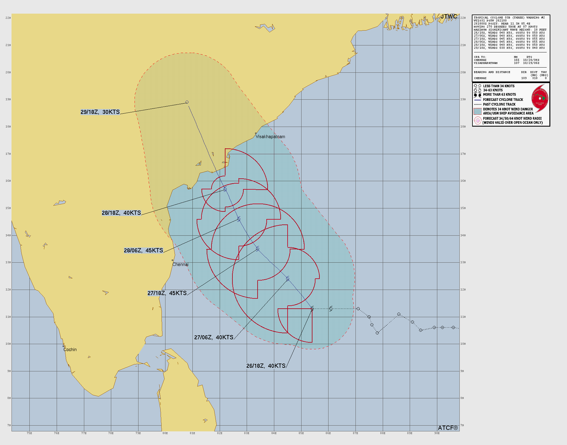
Tropical Storm THREE
Updated October 26, 2025 at 18:00 UTC
Located at 11.3°N, 85.4°E
Minimum Pressure: 998 mb
Maximum Winds: 40 kt
Radius of Maximum Wind: 40 nm
Environmental Pressure: 1009 mb
Storm Radius: 450 nm
Current Conditions


Forecasts
Storm History


Tropical Depression CHENGE
Updated October 26, 2025 at 18:00 UTC
Located at 7.5°S, 45.4°E
Minimum Pressure: 1004 mb
Maximum Winds: 25 kt
Radius of Maximum Wind: N/A nm
Environmental Pressure: N/A mb
Storm Radius: N/A nm
Current Conditions


Forecasts
Storm History


This page uses data from the National Hurricane Center (NHC) and Joint Typhoon Warning Center (JTWC), with best track files through the Automated Tropical Cyclone Forecast (ATCF) system. Microwave imagery courtesy of the U.S. Naval Research Laboratory.