Invest 94E
Updated June 23, 2026 at 00:00 UTC
Located at 12.6°N, 108.2°W
Minimum Pressure: 1008 mb
Maximum Winds: 25 kt
Current Conditions


Forecasts


Storm History


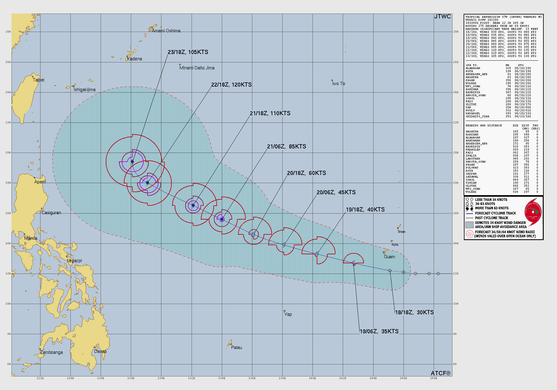
Typhoon MEKKHALA
Updated June 23, 2026 at 06:00 UTC
Located at 19.1°N, 124.8°E
Minimum Pressure: 946 mb
Maximum Winds: 110 kt
Radius of Maximum Wind: 12 nm
Environmental Pressure: 1004 mb
Storm Radius: 210 nm
Formerly Invest 92W
Current Conditions


Forecasts


Storm History


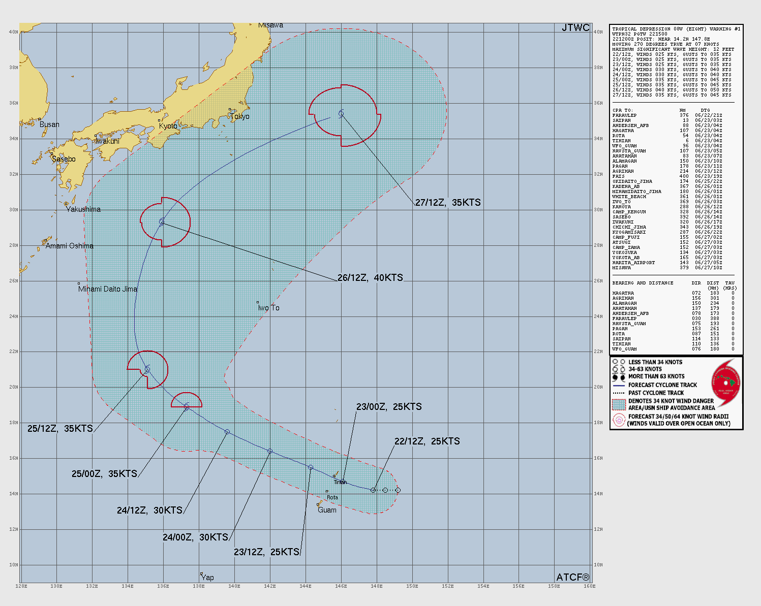
Tropical Storm HIGOS
Updated June 23, 2026 at 06:00 UTC
Located at 14.8°N, 144.9°E
Minimum Pressure: 1003 mb
Maximum Winds: 35 kt
Radius of Maximum Wind: 40 nm
Environmental Pressure: 1008 mb
Storm Radius: 140 nm
Formerly Invest 94W
Current Conditions


Forecasts


Storm History


This page uses data from the National Hurricane Center (NHC) and Joint Typhoon Warning Center (JTWC), with best track files through the Automated Tropical Cyclone Forecast (ATCF) system. Microwave imagery courtesy of the U.S. Naval Research Laboratory.