Current Storms:
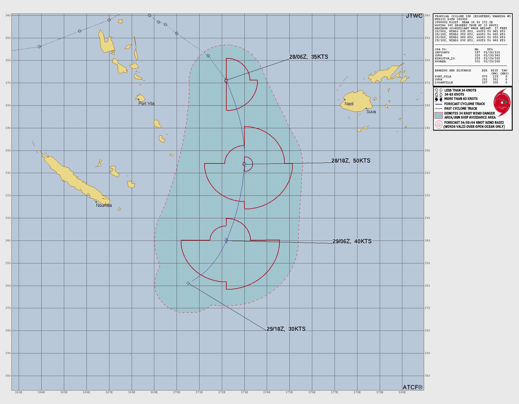
Tropical Depression EIGHTEEN
Updated January 30, 2026 at 06:00 UTC
12z Update Coming Soon
Located at 27.4°S, 170.5°E
Minimum Pressure: 998 mb
Maximum Winds: 30 kt
Radius of Maximum Wind: N/A nm
Environmental Pressure: N/A mb
Storm Radius: N/A nm
Current Conditions
Latest Satellite Image

Sea Temperatures

NRL 34/37 GHz Microwave Imagery

NRL 89 GHz Microwave Imagery

Forecasts
Latest Model Track Guidance

Latest Model Intensity Guidance
Official Forecast
Storm History

Pressure and Wind History

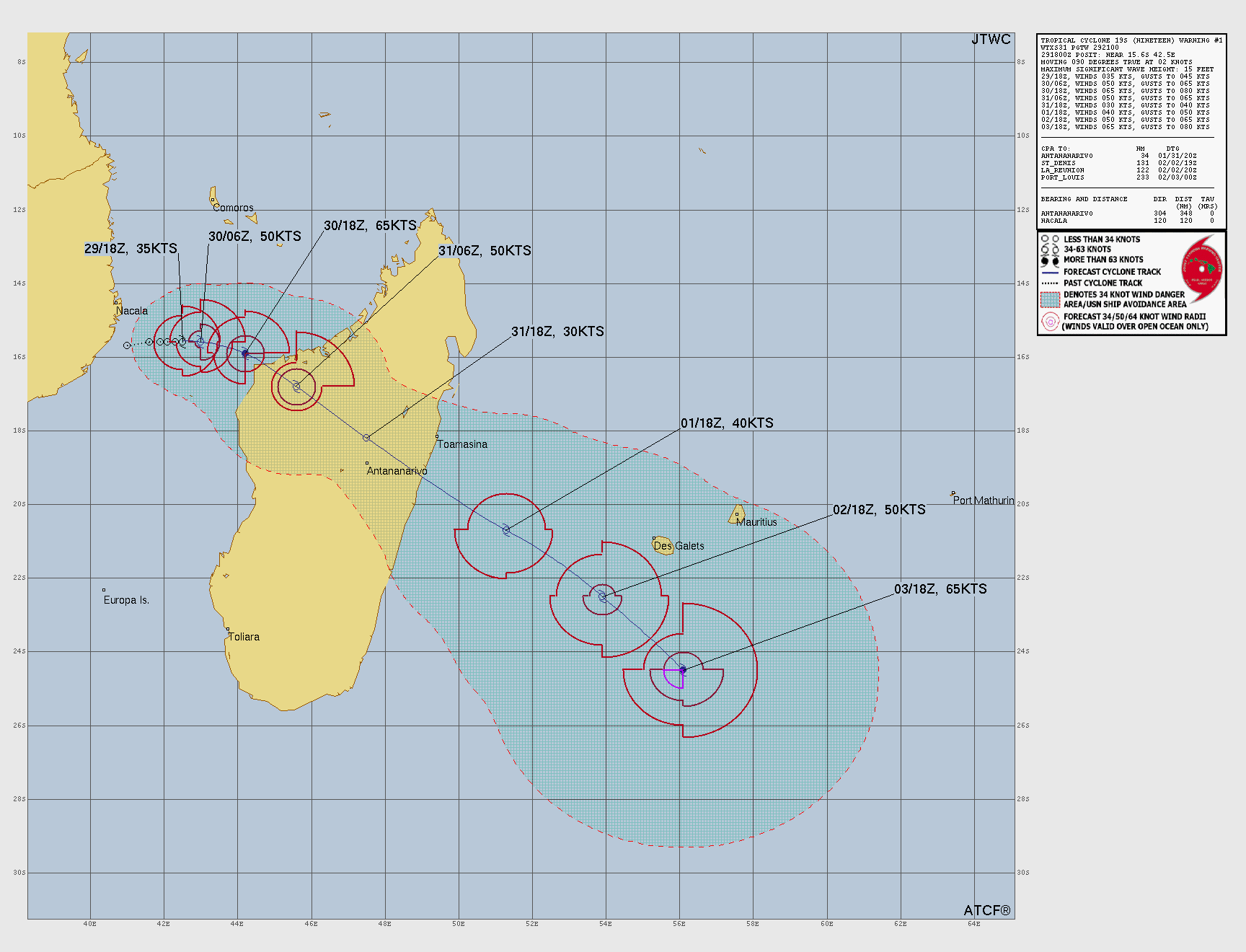
Tropical Cyclone FYTIA
Updated January 30, 2026 at 12:00 UTC
Located at 15.5°S, 43.0°E
Minimum Pressure: 973 mb
Maximum Winds: 80 kt
Radius of Maximum Wind: N/A nm
Environmental Pressure: N/A mb
Storm Radius: N/A nm
Current Conditions
Latest Satellite Image

Wind Radii
Sea Temperatures

NRL 34/37 GHz Microwave Imagery

NRL 89 GHz Microwave Imagery

Forecasts
Official Forecast
Storm History

Pressure and Wind History

This page uses data from the National Hurricane Center (NHC) and Joint Typhoon Warning Center (JTWC), with best track files through the Automated Tropical Cyclone Forecast (ATCF) system. Microwave imagery courtesy of the U.S. Naval Research Laboratory.