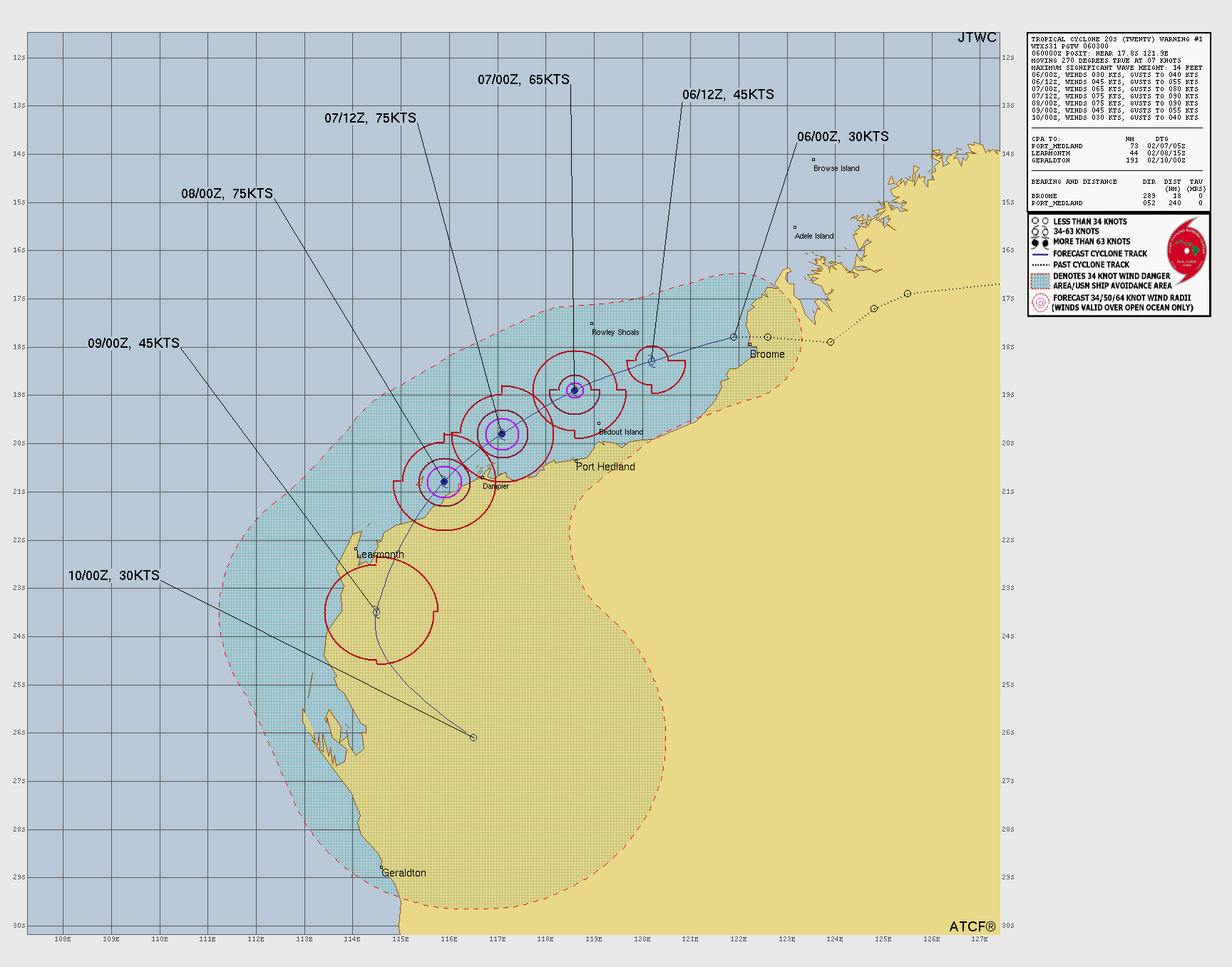
Current Storms:
Tropical Storm MITCHELL
Updated February 09, 2026 at 06:00 UTC
Located at 24.5°S, 113.4°E
Minimum Pressure: 986 mb
Maximum Winds: 50 kt
Radius of Maximum Wind: 20 nm
Environmental Pressure: 1002 mb
Storm Radius: 145 nm
Current Conditions
Latest Satellite Image

Wind Radii
Sea Temperatures

NRL 34/37 GHz Microwave Imagery

NRL 89 GHz Microwave Imagery

Forecasts
Official Forecast
Storm History

Pressure and Wind History

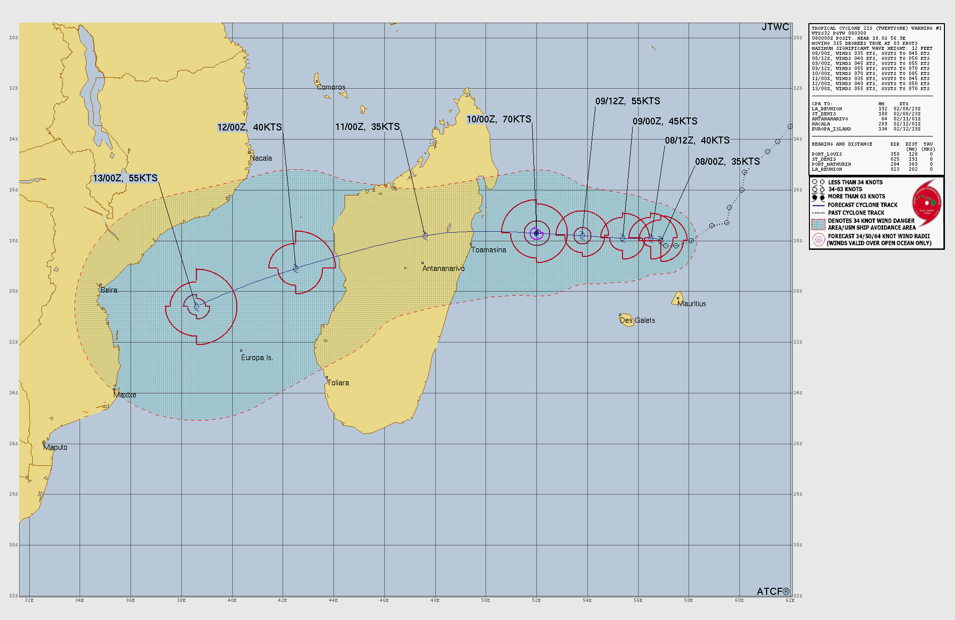
Tropical Storm GEZANI
Updated February 09, 2026 at 06:00 UTC
Located at 18°S, 54.6°E
Minimum Pressure: 996 mb
Maximum Winds: 50 kt
Radius of Maximum Wind: 25 nm
Environmental Pressure: 1010 mb
Storm Radius: 145 nm
Current Conditions
Latest Satellite Image

Sea Temperatures

NRL 34/37 GHz Microwave Imagery

NRL 89 GHz Microwave Imagery

Forecasts
Official Forecast
Storm History

Pressure and Wind History

This page uses data from the National Hurricane Center (NHC) and Joint Typhoon Warning Center (JTWC), with best track files through the Automated Tropical Cyclone Forecast (ATCF) system. Microwave imagery courtesy of the U.S. Naval Research Laboratory.