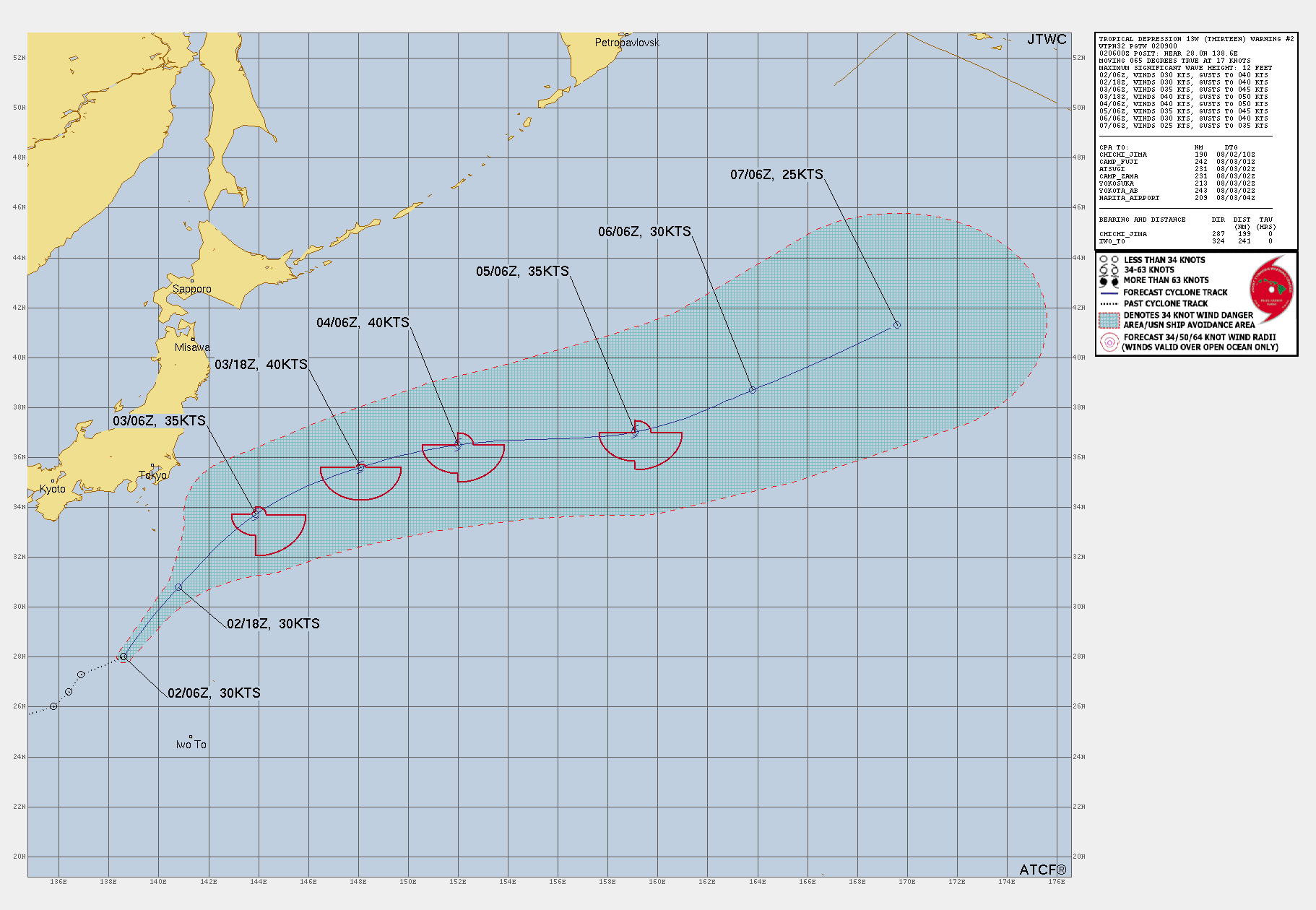
Tropical Storm THIRTEEN
Updated August 02, 2025 at 18:00 UTC
Located at 31°N, 140.5°E
Minimum Pressure: 997 mb
Maximum Winds: 35 kt
Radius of Maximum Wind: 65 nm
Environmental Pressure: 1002 mb
Storm Radius: 155 nm
Formerly Invest 93W
Current Conditions


Forecasts


Storm History


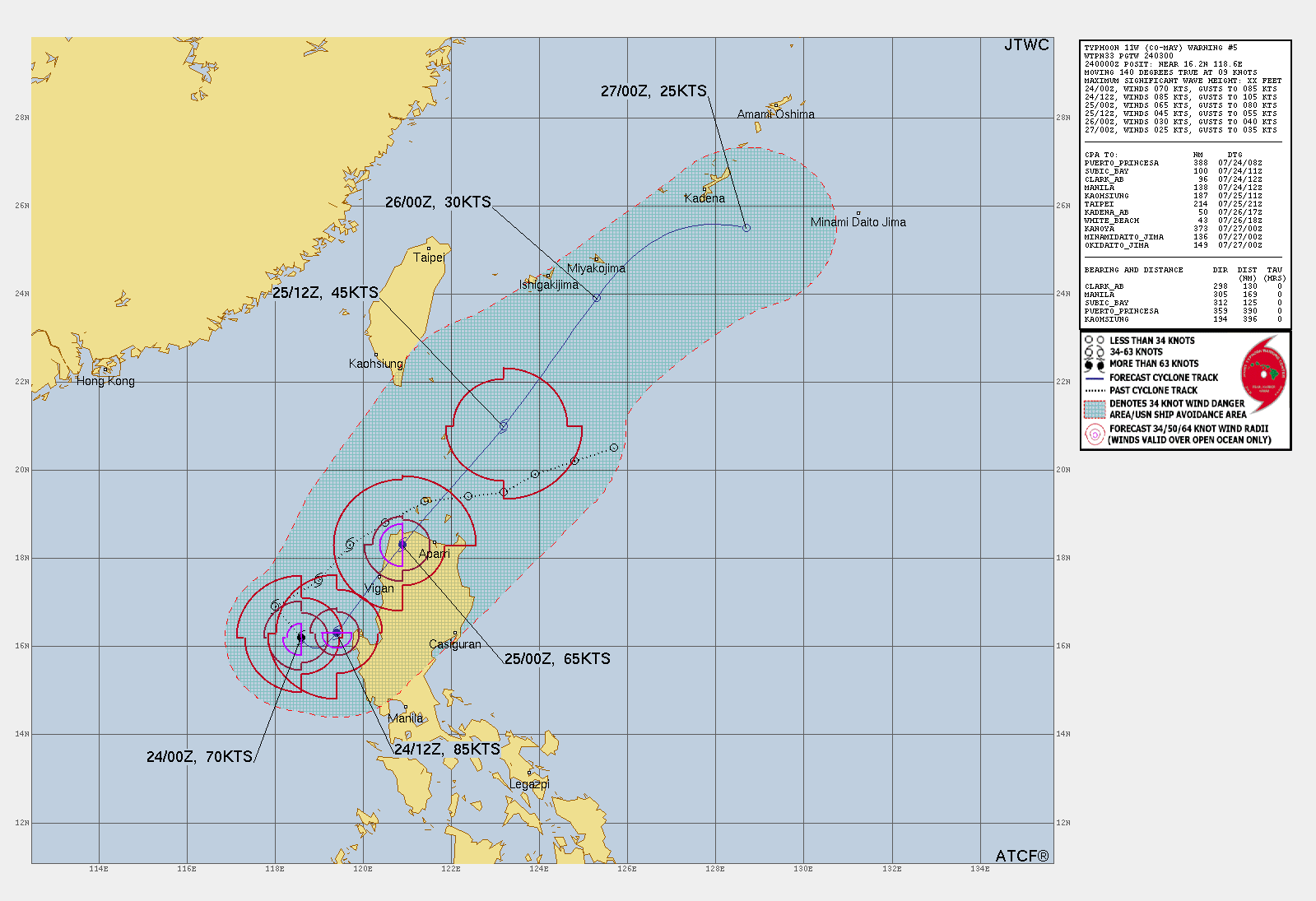
Remnants of CO-MAY
Updated August 02, 2025 at 18:00 UTC
Located at 33°N, 119.5°E
Minimum Pressure: 997 mb
Maximum Winds: 15 kt
Radius of Maximum Wind: 90 nm
Environmental Pressure: 998 mb
Storm Radius: 130 nm
Formerly Invest 99W
Current Conditions


Forecasts


Storm History


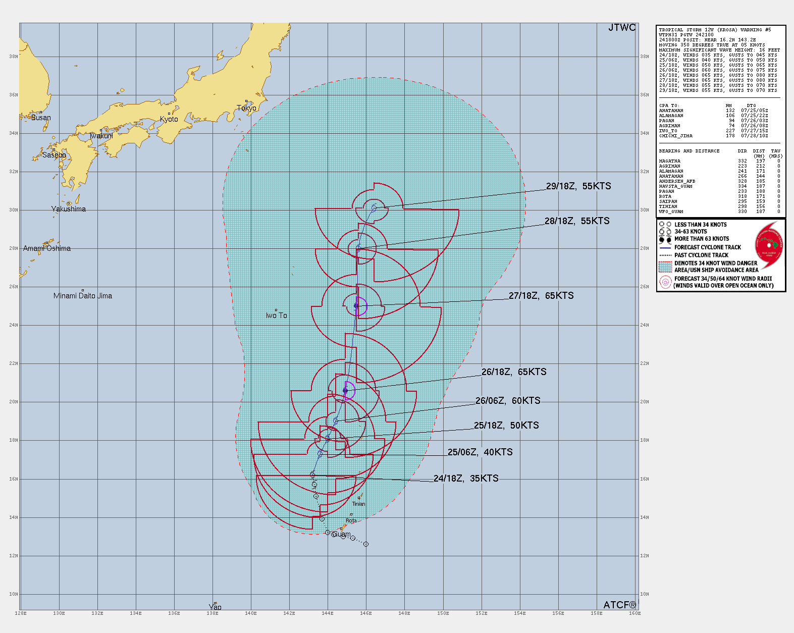
Tropical Storm KROSA
Updated August 02, 2025 at 18:00 UTC
Located at 39°N, 147.9°E
Minimum Pressure: 973 mb
Maximum Winds: 55 kt
Radius of Maximum Wind: 30 nm
Environmental Pressure: 998 mb
Storm Radius: 120 nm
Formerly Invest 98W
Current Conditions


Forecasts


Storm History


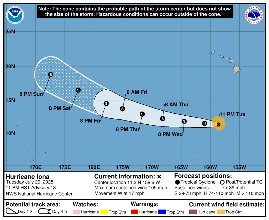
Tropical Depression IONA
Updated August 02, 2025 at 00:00 UTC
Located at 15.5°N, 178.8°W
Minimum Pressure: 1008 mb
Maximum Winds: 30 kt
Radius of Maximum Wind: 50 nm
Environmental Pressure: 1012 mb
Storm Radius: 115 nm
Formerly Invest 90C
Current Conditions


Forecasts


Storm History


Tropical Storm GIL
Updated August 02, 2025 at 18:00 UTC
Located at 18.6°N, 129.7°W
Minimum Pressure: 993 mb
Maximum Winds: 60 kt
Radius of Maximum Wind: 25 nm
Environmental Pressure: 1012 mb
Storm Radius: 210 nm
Formerly Invest 99E
Current Conditions


Forecasts


Storm History


Tropical Depression 90S
Updated August 02, 2025 at 12:00 UTC
Located at 5.1°S, 95.9°E
Minimum Pressure: 1006 mb
Maximum Winds: 30 kt
Current Conditions


Storm History


Invest 94W
Updated August 02, 2025 at 12:00 UTC
Located at 6°N, 161.2°E
Minimum Pressure: 1009 mb
Maximum Winds: 15 kt
Current Conditions


Storm History


Invest 95W
Updated August 02, 2025 at 12:00 UTC
Located at 26.4°N, 166.4°E
Minimum Pressure: 1009 mb
Maximum Winds: 20 kt
Current Conditions


Storm History


Invest 90E
Updated August 02, 2025 at 18:00 UTC
Located at 12°N, 109.8°W
Minimum Pressure: 1008 mb
Maximum Winds: 25 kt
Current Conditions


Forecasts


Storm History


This page uses data from the National Hurricane Center (NHC) and Joint Typhoon Warning Center (JTWC), with best track files through the Automated Tropical Cyclone Forecast (ATCF) system. Microwave imagery courtesy of the U.S. Naval Research Laboratory.